
A Paradigm Shift in Geographic Information Systems (GIS)
A generation ago—admittedly two—geographic information systems (GIS) relied on heavy hardware, niche software, and a small group of specialists who handled every map request. Today, the same type of analysis runs quietly behind the scenes to facilitate something as simple as ordering a pizza. Your phone tracks your location, estimates travel time, accounts for road closures, and selects the best route—all geospatial questions that used to require advanced technology to even consider putting together, and certainly nothing that could be done in real time.
For the uninitiated, GIS is a range of technologies that organize and analyze information by location so professionals can understand how different pieces of a system interact, how different systems themselves interact, and how those interactions shape outcomes. This framework brings different data types and features together into a unified environment to ask complex questions about the world. I won’t even get into the math behind it all.
I’ve spent a good chunk of my career in architecture, engineering, and construction (AEC). Changing how civil infrastructure projects are delivered, GIS tools provide rapid, location-aware insights. These tools show risks in context, trace how water moves through a system, identify asset vulnerabilities, project traffic patterns, and illustrate how infrastructure decisions ripple across communities. More importantly, GIS has become a common language for infrastructure owners and consultants, codified by the organizational value of digital data.
About The Author

Robb Kirkman
Geospatial Thinking Fosters Better Decisions
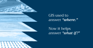
The expectation now is that decisions are data-informed and reflect how systems interact. GIS used to answer “where.” Now it helps answer “what if?” What happens if flow increases upstream, if a pipe reaches the end of its service life, or if a corridor closes during peak travel?
Long before design, teams evaluate how surrounding conditions will impact an asset and how that asset will affect the system. A new connection can change traffic behavior. A drainage shift can alter downstream flow. Identifying these interactions early requires a spatial mindset that acknowledges infrastructure as part of a network.
That mindset leads to better questions. Not just “Where is the problem?” but “What conditions created it?” and “What patterns will shape what happens next?” These are all questions that are better handled by starting with location. And it’s not just about answering the questions but communicating those outcomes in (near) real time with maps. The intuitive and engaging visualizations draw people in and help them contextualize the information.
GIS Is Embedded Throughout the Project Lifecycle
Infrastructure owners increasingly rely on geospatial information to understand their systems. Dashboards, map viewers, and asset inventories provide visibility into conditions and emerging risks. Beyond data storage, infrastructure owners want to leverage their data to strengthen daily management and long-range planning. That process begins with getting that data into the central database as soon as possible.
Early designation of the GIS as the primary database allows that value to be realized through an entire project, and GIS can support all phases of infrastructure development. Planners study system pressures and land-use patterns. Environmental teams use hydrologic and terrain models to evaluate flow paths, inundation extents, and habitat constraints. Designers test alignments and alternatives against changing site conditions. Construction and asset management teams link field observations to specific locations and monitor how assets respond as conditions shift. This creates a continuous, location-informed workflow that leads to more resilient outcomes.
Digital Solutions Drives Value
The reason for this paradigm shift with GIS is simple: value. The return on investment (ROI) of GIS has evolved from a peripheral “add-on” to a core value driver in AEC projects. Historically, GIS was justified through qualitative benefits. It offered better visualization, common data, improved coordination, or enhanced situational awareness, but it was also easy to cut when budgets tightened. Today, however, its return is directly quantifiable across the full project lifecycle. GIS now provides measurable efficiencies in site selection, field data collection, permitting, design coordination, digital twins, and asset management by reducing rework, shortening schedules, and lowering operational costs.
Those benefits used to be quantified to a (very agreeable) 3:1 or 5:1, meaning that every project dollar spent yielded 3 to 5 dollars in value returned. Now, that ROI is 15:1 or 20:1. I’ve even been part of projects where the results were over 50:1.
The Future of Predictive Network-Aware Decisions
GIS has evolved toward a deeper understanding of how infrastructure behaves under real-world conditions. AI and machine learning are accelerating this evolution by revealing patterns and relationships that were harder to identify in the past—indeed have become a core functionality in the software.
As the geospatial data streams get faster and more comprehensive, models will adjust alongside them and give infrastructure owners a clearer picture of conditions. That steady flow of information strengthens emergency response and infrastructure resilience.
If getting a pizza is already shaped by system-scale data, then the future of how infrastructure is built and managed will even more seamlessly integrate geospatial intelligence.